Some last minute information from a landholder pointed out that to reach Table Mountain, we would not only have to cross his property, which he was happy for us to do, but a neighbouring property, whose owner has had bad experiences with shooters and walkers entering without permission. He is not currently allowing access, so here's our "plan B".
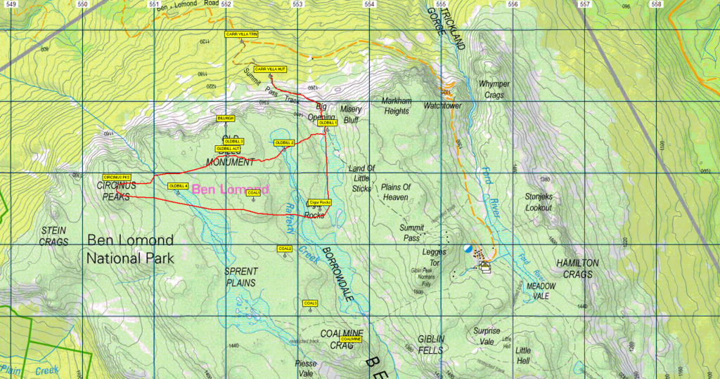
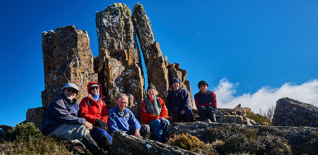
Boots N' All last visited Old Bills Monument in winter 2018. It involves following a fairly steep but well-formed track from the Carr Villa hut, then off-track to the west and up on to the open plateau to reach this unusual and prominent rock formation. The walk offers spectacular views of, and from, the northern escarpment of the Ben Lomond Plateau.
Walk route:
From the Carr Villa car park, at 1240 m altitude, we will walk along the Carr Villa track for about 1.5 km, climbing about 170m in the process. From here we head off track in a westerly direction, climbing about a further 70 m across alpine terrain. We will visit Old Bill's Monument. Depending on the energy and enthusiasm of the party (and leader), we may explore a little around that area, and eventually return to Carr Villa (a round trip of about 6 km), but an option is to wander a couple of km south to Sprent Plains, returning northeast via Cigar Rocks towards the Carr Villa track and the cars. This would add 3-5 km to the walk. Generally this should be relatively easy alpine walking, though it is mostly off track and therefore may be uneven underfoot in places. The steep ascent isn't particularly long - perhaps comparable to doing the Zig-Zag track from King's Bridge in Launceston 2-3 times in a row, so reasonable fitness is required. Energetic children should cope well. Hopefully, this week's rain will provide some drinking water, but please carry a litre per person.
Meeting Times and Places:
If you are interested in going on this walk, please phone Basil Tkaczuk on 0438 664 402 or 6331 1155 to book in (or reply to the email which will go out a few days ahead of the walk). The departure time is 8:00 am from Door of Hope carpark in South Launceston. An alternative meeting point could be the turnoff to Ben Lomond National Park at 8.30 am, or the Carr Villa Car Park at 8.50 am. However, you still need to contact the walk leader per details above if intending to walk. The leader should be notified of any other people you intend to bring along. Please be at any meeting place 5 minutes ahead of departure time. Please note that if you are bringing your vehicle, it will need to have a current valid Tasmanian Parks Pass.
To access this area from northern Tasmania:
From Launceston, proceed via St. Leonards (St. Leonards Rd and Blessington Rd) to the Ben Lomond Road, just short of Upper Blessington - about 48 km. Turn right into Ben Lomond Rd. A little over 10 km up this steep gravel road, take the right turn to Carr Villa and continue to the end of the road where there is a car park and building. The walk will start from there.
Warnings:
S Steep incline for at least part of the way
E Exposed alpine conditions – can be dangerous in poor weather if not fully equipped.
This walk is above 1100 metres altitude for the whole distance and can be very exposed if the weather is bad, even at this time of year. Be prepared! Walkers should wear sturdy boots due to uneven surfaces. Gaiters recommended due to off-track walking. You should always carry wet weather gear as well as warm clothing in case of sudden weather changes. For equipment guidelines, CLICK HERE.
Map details:Ben Lomond Plateau (northern area): 1:100000 map is Tasmap 8414 (St. Pauls) and 1:25000 map is 5440 (Giblin)
Map reference for Circinus Peaks (just west of Old Bill):
Short ref. n/a
Zone Easting Northing Latitude Longitude
55G 5 50 470 54 02 860 -41.52431 147.60493
Although there are several peakbagger peaks on the Ben Lomond plateau, none will be visited on this walk. For listing of peakbagger points, see the Hobart Walking Club Peakbagger's Guide (2000 revision) which can be downloaded (Excel) from http://tastracks.webs.com/peakbaggers.htm The same web page contains several other listings of Tasmanian peaks.
For GPX (.gpx) and Google Earth (.kml) versions of the track: Click here to download.
Direct links: GPX for this walk … KML for this walk
Right-click on the file and save target as to a location of your choice. (Suggest you click the Last modified at top to sort by date to get the most recent at top to find the file for the next walk).