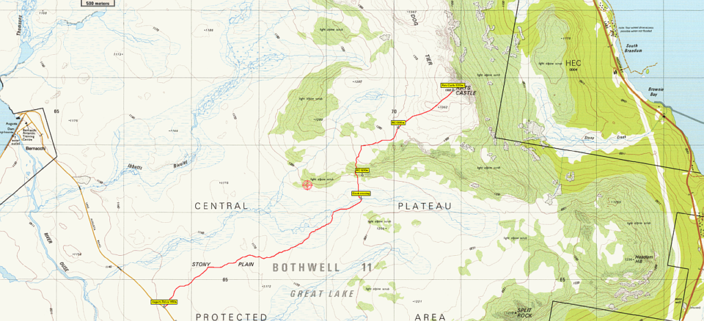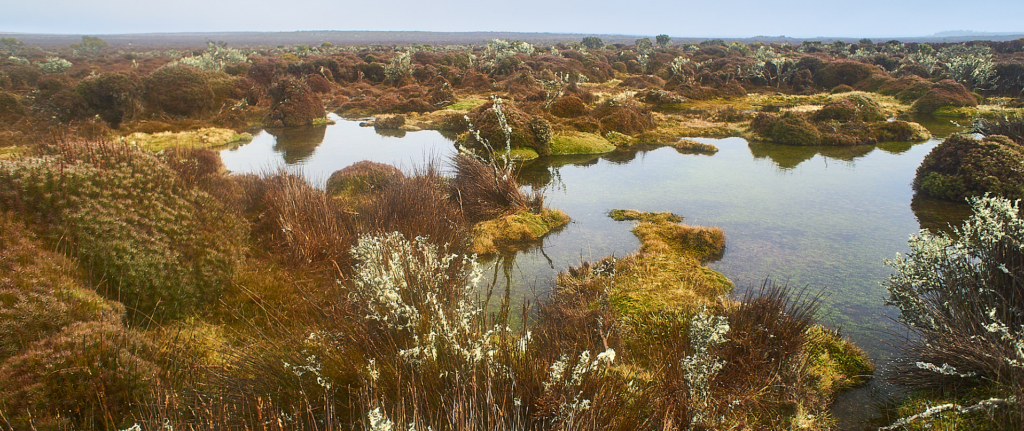
Last year, we made a winter attempt at this more unusual route to Rats Castle, but the shortness of the day, misty conditions and an unhelpful route choice meant we didn't quite get there. Returning by a much drier route showed us what we should do this time, and the somewhat longer days will hopefully give us plenty of time, and hopefully nicer weather. This walk, which still manages to get close to 1400 m altitude (about 225 m lower than Mt. Ossa) takes the much more gentle route from Stony Plain on the Lake Augusta Rd, already 1150 m altitude. This is an off-track walk, and may involve sections of boulder field and some bands of scrub, although the area was largely burnt out in early 2019. Due to the exposed alpine conditions, walkers need to be well-equipped and willing to turn back if conditions deteriorate. Resilient children with some experience of poor conditions could manage this walk, which is rated medium.
Walk route:
The walk begins at a point on the Lake Augusta Rd about 8.6 km from the Liawenee turnoff. Heading in a northeasterly direction, Stony Plain is crossed for about 3 km including an unnamed creek crossing, before gradually rising over the next 1.5 km, then more steeply over the final km to reach the summit, which should provide extensive views (weather permitting) of the Great Lake area, south even as far as Wyld’s Craig and Mt. Field, and southwest to the Walls of Jerusalem and the Geryons.
Meeting Times and Places:
If you are interested in going on this walk, please phone Ian Waterhouse via 0418 271 372 to book in. The departure time is 8:00 am from Door of Hope carpark in South Launceston. The alternative meeting place/time is at the “train park” in Deloraine at 9:05 am. (If coming from east, cross the bridge and turn right at the roundabout). If you would like to arrange to meet the group at these places or elsewhere, please arrange with the leader, and please be at any meeting place 5 minutes ahead of the listed time. The leader must be notified of any other people you intend to bring along.
To access this area from northern Tasmania: From Launceston, head towards Deloraine on the Bass Highway (50 km) and take the first (eastern) turn from the highway into Deloraine. Continue into the town and turn left immediately before the bridge (unless going to the meeting place across the main bridge and turn right to find toilets and old locomotive – see above). From Deloraine, head south along the “Lake Highway” – now officially Highland Lakes Rd. (but the first bit may be called Meander Rd!). Make sure to turn left after 7 km at signposted junction for Highland Lakes Rd. Continue south through Golden Valley, up past Quamby Bluff and Projection Bluff and past Pine Lake. Continue south through Breona, Brandum and other groups of shacks along shores of Great Lake until Liawenee is reached (approx. 58 km from Deloraine). Turn right into Lake Augusta Rd. The start of the walk is at a blocked off turnoff 8.6 km from the Liawenee turnoff.
Warnings:
E… Exposed alpine conditions – can be dangerous in poor weather if not fully equipped
M Marshy or muddy sections – be prepared to walk with wet feet.
S Steep incline for at least part of the way
Walkers are advised to wear strong shoes or boots. Gaiters recommended due to off-track walking. You should always carry wet weather gear as well as warm clothing in case of sudden weather changes. For equipment and safety guidelines, Click Here.
Map details: Rats Castle: 1:100000 map is Tasmap 8214 (Meander) and 1:25000 map is 4636 (Split Rock)
Map references:
Short ref. 708678
Zone Easting Northing Latitude Longitude
55G 4 70 990 53 67 990 -41.83945 146.65059
Rats Castle is worth 1 peakbagger point. For listing of peakbagger points, see the Hobart Walking Club Peakbagger’s Guide (2000 revision) which can be downloaded (Excel) from http://tastracks.webs.com/peakbaggers.htm The same web page contains several other listings of Tasmanian peaks.
GPX version of the track: Click here to download. Google Earth version of the track: Click here to download.
Right-click on the file and save target as to a location of your choice. (Suggest you click the Last modified at top to sort by date to get the most recent at top to find the file for the next walk).