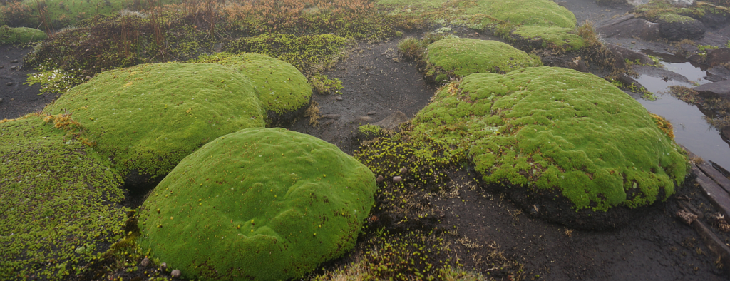
A prominent crag above the Western Creek and Chudleigh areas, Mother Cummings Peak (alt. 1190m) is distinguished from the higher, but less prominent, Cummings Head (alt. 1260m) a little over 2 km to the south, not part of the plan for this walk, but easily reachable from the track we will follow. On a clear day, expansive views cover the northern region right to the coast, with equally impressive views of the Mt Ironstone/Bastion Bluff area and the plateau escarpment running east past Quamby and Projection Bluff. There is a lovely meadow of cushion plants in the alpine valley below the summit, which will likely be visited on the way down.
Walk Route:
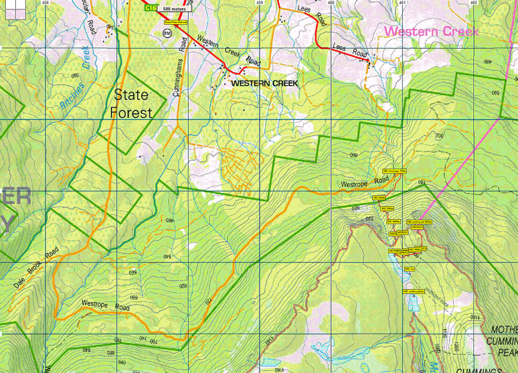
From the eastern end of Westrope Rd (alt. 750m), the track climbs gradually in a southwest direction for about 400m before a steep ascent southward, gaining 250 metres over the next 800 metres - quite demanding, but very rewarding when the track levels out for the next 200 metres or so (alt. 1060m). The route now swings east for about 300 metres, climbing again, but not so steeply, then north towards the peak (alt. 1190m), a further 400 metres, with some scrambling over boulders over the last 50 metres or so. Despite the steep climb, the walk should be suited to energetic younger children and reasonably fit adults. Even allowing for plenty of breathers, it should take under 2 hours to reach the summit. Because of the exposed alpine conditions, walkers must be fully prepared for poor weather. Please see the warnings below.
Meeting Times and Places:
If you are interested in going on this walk, please phone your walk leader, John Tabor ph. 6428 6512, mob. 0475 566 389 to book in. The departure time is 8:30 am from the Door of Hope Church car park, Launceston. Suggested meeting places if coming from elsewhere are at the Deloraine train park at 9:05 am or Westrope Rd turnoff at 9:30 am. If you would like to arrange to meet the group at these places or elsewhere, please arrange with the leader, and please be at any meeting place 5 minutes ahead of the listed time. The leader must be notified of any other people you intend to bring along.
To access this area from northern Tasmania: From Launceston, proceed along the Bass Highway to Deloraine (about 51 km). Follow the off-ramp into Deloraine and when crossing the bridge, turn right at roundabout to enter the “train park” car park. (If you were not meeting the group there, you would not turn off at the eastern exit into Deloraine. Instead, continue across Meander R. and uphill to the western exit, and to the roundabout at start of Mole Creek Rd.) After leaving the train park, follow the main street uphill through Deloraine to reach the large roundabout. Turn left into Mole Creek Rd. and go about 8 km before turning left into Dairy Plains Rd. Go all the way through Dairy Plains Rd. (several right hand turns and 2 junctions where you need to follow the signs). When you arrive at the T junction with Western Creek Rd, turn right and 800m further on, turn left up Westrope Rd. Go more or less straight for 4 km south, continue past the junction of Dale Brook Rd. and after just under 1 km further, the road swings sharply left, soon levelling out and continuing east and then northeast for a further 6 km to reach the parking area at the end of the road. Westrope Rd. is all gravel, and somewhat degraded in parts, but should be accessible for 2WD vehicles with reasonable clearance.
Warnings:
The following codes [from our 2022 walks calendar] apply:
S Steep incline for at least part of the way
B Boulder field – (short distance only) walkers need to be able to confidently step from rock to rock.
E Exposed alpine conditions ; can be dangerous in poor weather if not adequately equipped.
You should carry wet weather gear as well as warm clothing in case of sudden weather changes. Also bring your lunch, a drink and snacks. For equipment and safety guidelines, Click Here.
Mother Cummings area: 1:100000 map is Meander (Tasmap 8214) and 1:25000 map for upper area is Quamby Bluff (TasMap 4638).
Short ref. n/a
Zone Easting Northing Latitude Longitude
55G 4 61 220 53 87 525 -41.66309 146.53419
No peakbagger points will be reached on this walk (although the nearby Cummings Head is worth 1 peakbagger point). For listing of peakbagger points, see the Hobart Walking Club Peakbagger’s Guide (2000 revision) which can be found and downloaded (as an Excel spreadsheet) from http://tastracks.webs.com/peakbaggers.htm The same web page contains several other listings of Tasmanian peaks.
GPX version of the track: Right-click here to download. Google Earth version of the track: Click here to open in Google Earth [if available on your device].
For the full listing of our extensive GPX and KML files, click here. To find one in a hurry, Ctrl-F to bring up a search box, and type in part of the name of the walk. For some walks, there will be more than one version. Right-click on the file and save target as to a location of your choice.