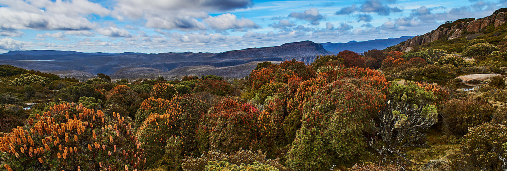
It's getting towards the alpine flower season, and what could be nicer than a late spring ramble across the alpine meadows northwest of Lake Mackenzie, with the cars already doing the serious climbing! The early part of the walk promises extensive views south towards the Walls of Jerusalem, with the perspective broadening as higher ground is reached, culminating in spectacular 360° views from Western Bluff East, affectionately known in bushwalking circles as "The WBeast" - but it's not at all intimidating, rising less than 50 metres above the southern approach. The route passes through a variety of alpine vegetation, but there are wide expanses of low alpine vegetation which should make for comfortable walking. Energetic and resilient children should be able to manage this walk.
Walk route:
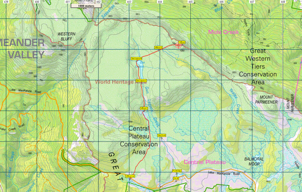
From the car park near the western end of the Lake Mackenzie aqueduct, alt. 1150m, the route heads north over gently undulating country, skirting to the right of a low escarpment and generally following the line of Gun Creek. Gun Lagoon is reached after about 3.5 km, with about 60 metres alt. gained over the final km. A further 600 m or so brings you to the northern end of the lagoon, with the line now heading ENE for 1.6km to reach the WBeast. Your leader may vary the starting point, and perhaps extend east or west on the return trip to make the walk more of a circuit. Total return distance is about 12 km.
Meeting Times and Places:
If you are interested in going on this walk, please contact Phil Dawson, email pidasms@gmail.com or ph. 6382 3561 after 6:30 pm. The departure time is 7:30 am from Door of Hope car park. Meeting points along the way could be 8.00 at the Mole Creek Road roundabout at the western end of Deloraine, 8.20 at Mole Creek or 8:35 at the Lake Mackenzie (Devil’s Gullet) Road junction with the Mersey Forest Road. If you would like to arrange to meet there or elsewhere, please arrange with the leader, and please be at any meeting place 5 minutes ahead of the listed time. The leader must be notified of any other people you intend to bring along.
To access this area from northern Tasmania:
To reach the area from Launceston, proceed along the Bass Highway to Deloraine (about 51 km), but do not turn off at the eastern exit into Deloraine. Instead, continue across Meander R. and uphill to the western exit, and to the roundabout at start of Mole Creek Rd. A further 24km will bring you to Mole Creek. Continue west past Mole Creek, on what is now Liena Rd, making sure you turn south at the caravan park 4 km from the town. The road continues west until about 14 km from Mole Creek, it branches south, now called Mersey Forest Road. A little over 6 km south, you will pass a turnoff to Cradle Mountain and Sheffield, and about 300 metres further, take the turn on left to Devil’s Gullet/Lake Mackenzie. Follow this road for 13 km to where the ground on the left becomes more level with open leads between the vegetation, which is where the walk starts.
Warnings:
The following codes [from our 2022 walks calendar] apply:
D Drive distance requires early departure
M (depending on off-track sections) Marshy or muddy sections be prepared to walk with wet feet.
E… Exposed alpine conditions – can be dangerous in poor weather if not fully equipped.
This walk is above 1100 metres altitude for the whole distance and can be very exposed if the weather is bad, even at this time of year. Be prepared! Walkers should wear sturdy boots due to uneven surfaces. Gaiters recommended due to off-track walking. You should always carry wet weather gear as well as warm clothing in case of sudden weather changes. For equipment guidelines, CLICK HERE.
Map details:
Western Bluff East (alt. 1350 m): 1:100000 map is Tasmap 8114 (Mersey) and 1:25000 map is 4438 (Lake Mackenzie) for the southern part of the walk, then 4439 (Mole Creek).
Map reference:
Short ref. 479815
Zone Easting Northing Latitude Longitude
55G 4 44 717 53 92 133 -41.37236 146.20184
For the peakbaggers, No peakbagger points will be reached on this walk. For listing of peakbagger points, see the Hobart Walking Club Peakbagger’s Guide (2000 revision) which can be downloaded (Excel) from http://tastracks.webs.com/peakbaggers.htm The same web page contains several other listings of Tasmanian peaks.
For GPX (.gpx) and Google Earth (.kml) versions of the track: Click here to download.
Direct links: GPX for this walk … KML for this walk
Right-click on the file and save target as to a location of your choice. (Suggest you click the Last modified at top to sort by date to get the most recent at top to find the file for the next walk).