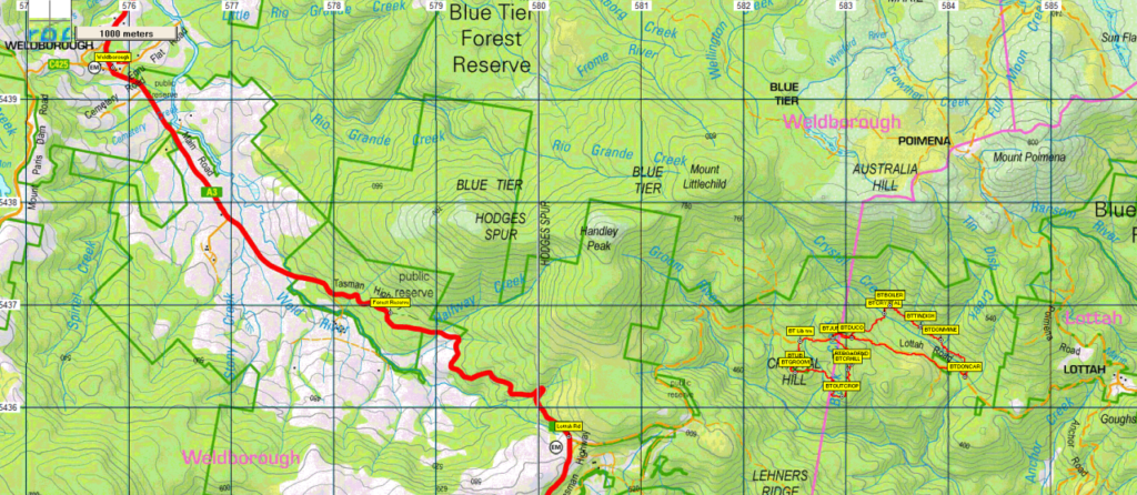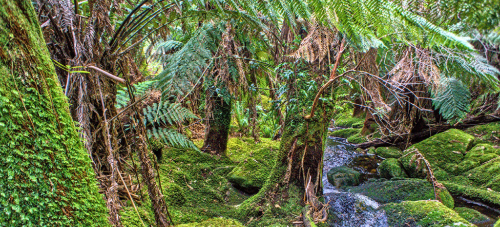
This walk will explore some rarely visited parts of this iconic area of rainforest in the northeast of Tasmania. We will initially stop at the Weldborough Pass Rainforest Walk for a 15 minutes warm-up walk through beautiful old growth myrtle forest. After that we will move on to a spot along Lottah Road where we will follow a taped track through the forest visiting some old mine sites and other relics as well as enjoying some of the beautiful forest and creeks found within it.
Initially we will walk for less than a kilometre to the Don Mine which we will explore. We will then proceed another 1.3 km approx, crossing Tin Dish Creek and follow the northern side of Crystal Creek until we come to The Boiler, a relic of by gone mining days. From here we turn sharp left down to Crystal Creek, a beautiful spot for a break. Another kilometre’s walking will get us to the Duco Adit, another old mine which forms a tunnel under Lottah Road.
We will then walk up Lottah Road for a short distance and then turn left down an old overgrown road, until we pick up another taped track that will take us to Crystal Hill area. After about a kilometre of walking we will find a rocky outcrop with some views which will form a nice spot for another break. Then we proceed along the track for another 1.5 km past the Liberator Mine, until we emerge on Lottah Road again, which will complete our walk. Here there will be a car (prepared earlier), which will take the drivers back to the start while the rest of the walkers wait for the cars to come and collect them to head home. The walk will all be along tracks and should be about 6-7 km in total, with only about 150 m of climbing spread throughout the day. It is rated easy-medium and would be suitable for agile children. It will be helpful to have a head torch or something similar in order to explore the dark caves and tunnels we will come across on the walk.
Meeting Times and Places
If you are interested in going on this walk, please phone Phil Andrew on 0408 014 757 or email pandrew.tas@gmail.com. The departure time is 8:00 am from Door of Hope car park. If you wish to meet with the group at any other place, please arrange with the leader. However, you still need to contact the walk leader, if intending to walk. The leader should be notified of any other people you intend to bring along. Please be at any meeting place 5 minutes ahead of departure time.
To access this area from northern Tasmania:
Proceed from Launceston via Northern Outlet, turning off at University Connector to head for Lilydale Rd. Follow through Lilydale and continue through Lebrina, Golconda, Nabowla and Lietinna to Scottsdale (70 km from Launceston via this route). The alternative Tasman Highway route has recently re-opened after repairs from flood damage, and may still be subject to delays. Check this website. That route follows the Tasman Highway through Waverley, crossing the Sideling to reach Scottsdale. Please advise the leader if travelling independently.
From Scottsdale, follow the Tasman Highway SE a further 53 km through Tonganah to Branxholm, then Derby and on past Morinna and the Weldborough Pass to Weldborough. (Alternatively the Mt Paris Dam road can be taken to the right about 1.6 km east of Branxholm through to Weldborough, though this is a gravel road). From Weldborough, continue a further 4 km to the Weldborough Rainforest Walk car park which is signposted. After this it is a further 2.5 km to the Lottah Rd turnoff on the left, then another 6 km along Lottah Rd to a car park on the left, just after you cross Crystal Creek over a good bridge. This is where the main walk will commence.
Allow about 1 hour 40 minutes from Launceston to Weldborough.
Warnings:
The following codes apply from our 2023 walks calendar:
D Drive distance requires early departure
S Steep incline for at least part of the way
M Marshy or muddy sections – be prepared to walk with wet feet .
Winter bushwalking can be dangerous in poor weather if not adequately equipped; For equipment guidelines, Click here.
Map details: Crystal Hill: 1:100000 map is Tasmap 8415 (Forester) and 1:25000 map is 5642 (Victoria)
Map reference:
Short ref. n/a
Zone Easting Northing Latitude Longitude
55G 5 82 503 54 36 344 -13.2047 147.590565
No peakbagger points will be visited on this walk. For listing of peakbagger points, see the Hobart Walking Club Peakbagger’s Guide (2000 revision) which can be downloaded (Excel) from http://tastracks.webs.com/peakbaggers.htm The same web page contains several other listings of Tasmanian peaks.
GPX version of the track: Right-click here to download. Google Earth version of the track: Click here to open in Google Earth [if available on your device].
Click here to browse our entire collection of walk tracks, including to find GPX (.gpx) and Google Earth (.kml) versions of the track for this walk.
Click here to learn about using your phone as a navigation device, or to find out about handheld GPS devices.