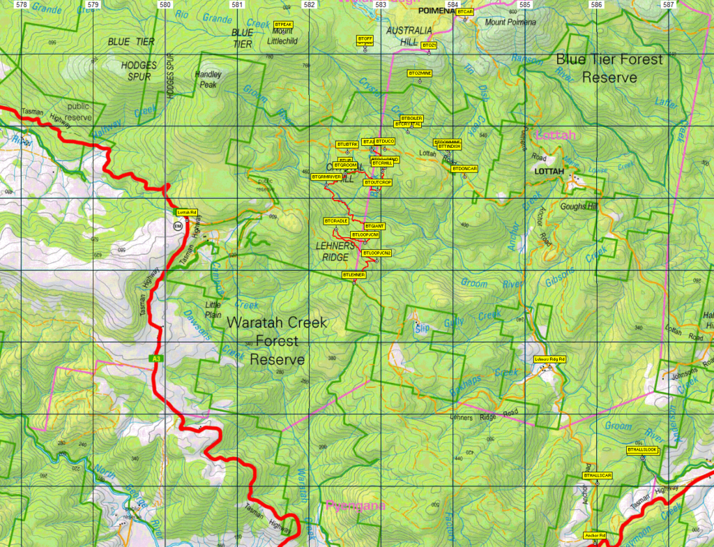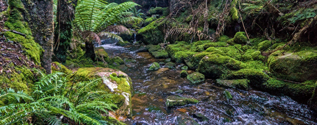
This is another walk that will explore some rarely visited parts of the Blue Tier, an iconic area of creeks and rain forest in the northeast of Tasmania. We will begin by parking on Lottah Road at a junction with a disused road. We will then walk along this road and onto a track that we followed at the finish of the last Blue Tier walk in April this year. This will take us around the Crystal Hill area until we reach a track junction after about 1.7 km. From there we will head steeply downhill for about 500m through beautiful forest until we reach the Groom River. We cross this several times over the next 2 hours or so as we explore the river and surrounding forest, an area regarded by many as the "holy grail" of the Blue Tier. We will stop for lunch somewhere along the river. After about 2 km we will come to the Big Tree, said to be the widest living tree in Australia. Over the next hour we will see some more huge trees, such as the Cradle Tree and others, as we make our way along the 2.5 km well graded tourist loop track to the Giant Tree car park on Lehners Ridge Road. A car will be waiting for us there, prepared earlier. Drivers will go back to the start to collect the cars while other walkers can either wait there, or make their way up Lehners Ridge road to Lottah Road if they have the energy.
The walk is only about 6.5 km in total, starting and finishing at around 540m altitude. There will be about 150 m of descent to the lowest point on the Groom River, some of this quite steep, and then of course the same amount of ascent to reach the car park at the other end, although a lot of this is gradual. The walk follows a taped route all the way, but this is mostly not on a formed track and is hard to follow in places. It requires stepping over logs and rocks and includes some slippery sections where care is required with footing. There are also at least three potentially slippery river crossings, and the water level will be dependent on how much rainfall this area has experienced in the preceding few days. Therefore it is rated medium, and will be suitable to reasonably fit adults and energetic children.
Meeting Times and Places
If you are interested in going on this walk, please phone the walk leader, Phil Andrew, on 0408 014 757 or email pandrew.tas@gmail.com, to register. The departure time is 8:00 am from Door of Hope car park. If you wish to meet with the group at any other place, please arrange with the leader. However, you still need to contact the walk leader, if intending to walk. The leader should be notified of any other people you intend to bring along. Please be at any meeting place 5 minutes ahead of departure time.
To access this area from northern Tasmania:
Proceed from Launceston via Northern Outlet, turning off at University Connector to head for Lilydale Rd. Follow through Lilydale and continue through Lebrina, Golconda, Nabowla and Lietinna to Scottsdale (70 km from Launceston via this route). The alternative Tasman Highway route has recently re-opened after repairs from flood damage, and may still be subject to delays. Check this website. That route follows the Tasman Highway through Waverley, crossing the Sideling to reach Scottsdale. Please advise the leader if travelling independently.
From Scottsdale, follow the Tasman Highway SE a further 53 km through Tonganah to Branxholm, then Derby and on past Morinna and the Weldborough Pass to Weldborough. (Alternatively, Mt Paris Dam Road can be taken to the right about 1.6 km east of Branxholm through to Weldborough, though this is a gravel road). From Weldborough, continue a further 6.5 km to the Lottah Rd turnoff on the left, then another 4.5 km along Lottah Rd until you reach a junction with a disused road to the right. This is where the walk will commence. Allow about 2 hours to get there from Launceston.
Warnings:
The following codes apply from our 2023 walks calendar:
D - Drive distance requires early departure
S - Steep incline for at least part of the way
M - Marshy or muddy sections – be prepared to walk with wet feet .
Early spring bushwalking can be dangerous in poor weather if not adequately equipped; For equipment guidelines, Click here.
Map details: Crystal Hill: 1:100000 map is Tasmap 8415 (Forester) and 1:25000 map is 5642 (Victoria)
Map reference:
Short ref. n/a
Zone Easting Northing Latitude Longitude
55G 5 82 503 54 36 344 -13.2047 147.590565
No peakbagger points will be visited on this walk. For listing of peakbagger points, see the Hobart Walking Club Peakbagger’s Guide (2000 revision) which can be downloaded (Excel) from http://tastracks.webs.com/peakbaggers.htm The same web page contains several other listings of Tasmanian peaks.
GPX version of the track: Right-click here to download. Google Earth version of the track: Click here to open in Google Earth [if available on your device].
Click here to browse our entire collection of walk tracks, including to find GPX (.gpx) and Google Earth (.kml) versions of the track for this walk.
Click here to learn about using your phone as a navigation device, or to find out about handheld GPS devices.