Frome Falls – Sat. 13th January 2024
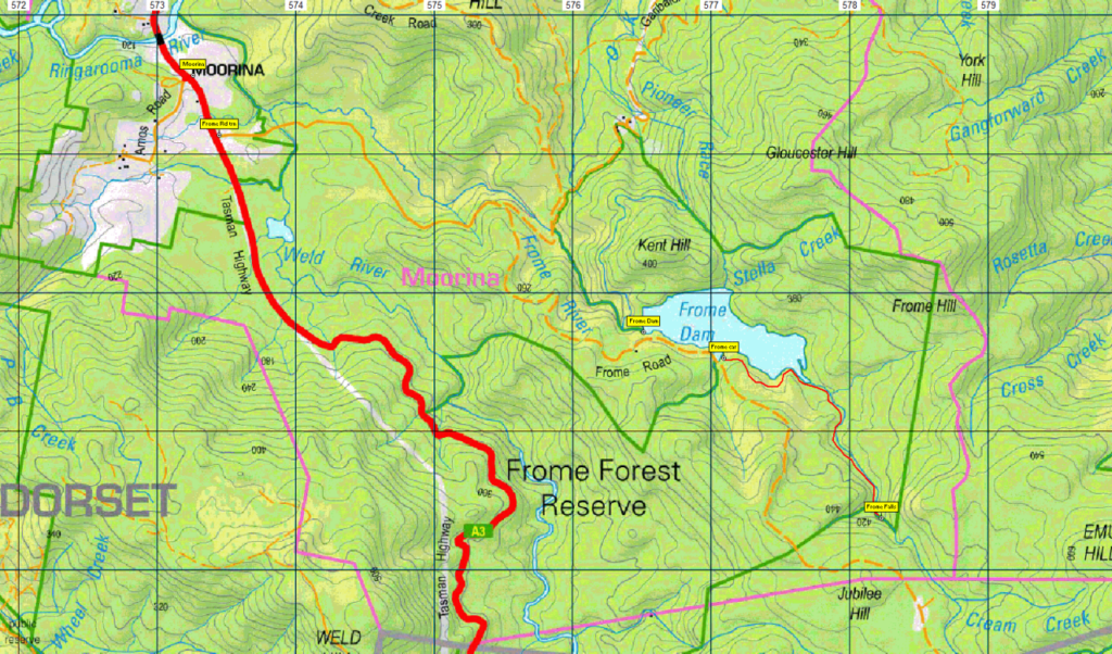
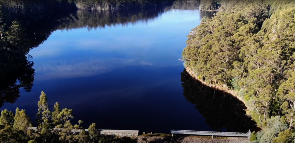
Perhaps you haven’t even heard of Frome Falls? You are more likely to have heard of, or even visited, the now closed Moorina Power Station, just east of the tiny northeast town of Moorina. Its water source was the Frome Dam, and the falls are about 3 km SE of the dam. The walk takes place in another area that once teemed with tin miners, and the once highly productive Cream Creek field is just half a km further upstream. The walk will take about 3 hours return (at a relaxed pace – it’s only about 2.5 km each way with an altitude gain of about 50m), and follows the river, with a lunch break at the falls. Rated medium, due to a moderate gain in altitude, but would be suitable for energetic children and reasonably fit adults. Your leader may take you further on past the falls if time and energy levels permit.
Meeting Times and Places
If you are interested in going on this walk, please phone Peter Davies on 0414 516 268. The departure time is 8:30 am from Door of Hope car park. There will be a morning tea break at Scottsdale, perhaps at the Northeast Park, on the southern outskirts of the town. If you wish to meet with the group at any other place, please arrange with the leader. You could meet the party at the Tasman Hwy/Frome Rd intersection by the golf course at Moorina between 10:30 and 11am. However, you still need to contact the walk leader, if intending to walk. The leader should be notified of any other people you intend to bring along. Please be at any meeting place 5 minutes ahead of departure time.
To access this area from northern Tasmania:
Proceed from Launceston via Northern Outlet, turning off at University Connector to head for Lilydale Rd. Follow through Lilydale and continue through Lebrina, Golconda, Nabowla and Lietinna to Scottsdale (70 km from Launceston via this route). The alternative Tasman Highway route has recently re-opened after repairs from flood damage, and may still be subject to delays. Check this website. That route follows the Tasman Highway through Waverley, crossing the Sideling to reach Scottsdale. Please advise the leader if travelling independently. We will have a morning tea break at Scottsdale.
From Scottsdale, follow the Tasman Highway SE a further 45 km through Tonganah to Branxholm, then Derby and on to Moorina, situated where the Tasman Hwy crosses the Ringarooma River for the 3rd time (after Branxholm and Derby). Frome Rd turns off left about 1/2 km further south. The walk will commence alongside the Frome Dam, 5 km from the turnoff along a rather rough gravel road.
Allow about 1 hour 40 minutes from Launceston to Moorina (but we will be stopping at Scottsdale).
Warnings:
The following codes apply from our 2024 walks calendar:
S Steep incline for at least part of the way
M Marshy or muddy sections – be prepared to walk with wet feet.
Our leader mentioned that there were some leeches last time he visited, so Aerogard and gaiters might be useful.
No other special clothing recommendations, but for general bushwalk equipment guidelines, Click here.
Map details: Frome Falls: 1:100000 map is Tasmap 8415 (Forester) and 1:25000 map is 5644 (Derby)
Map reference:
Short ref. n/a
Zone Easting Northing Latitude Longitude
55G 5 78 229 54 43 380 – ? 147.55943
No peakbagger points will be visited on this trip. See The Peakbaggers Points List, which can be downloaded (Excel) from http://tastracks.webs.com/peakbaggers.htm which contains the 1983 and 2000 versions, developed from the original 1968 Hobart Walking Club version. A parallel and more recent but not identical list system is The Abels – also available on the same website, which also contains some other listings of Tasmanian peaks.
For GPX (.gpx) and Google Earth (.kml) versions of the track: Click here to browse our collection.
Direct links: GPX for this walk … KML for this walk
Right-click on the file and save target as to a location of your choice. (Suggest you click the Last modified at top to sort by date to get the most recent at top to find the file for the next walk).